New Jersey Future Blog
New Jersey Future Vulnerability Assessment Process To Be Presented at National Conference
February 6th, 2015 by Elaine Clisham
Methodology quantifies damage and tax-base loss at the parcel level from
sea-level rise and severe weather.
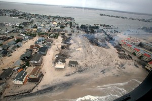
A new process, developed by New Jersey Future and the environmental engineering firm Princeton Hydro, that calculates a coastal community’s financial exposure to future severe weather and sea-level rise will make its national debut at the American Planning Association annual conference in April 2015.
The vulnerability assessment uses parcel-based maps and data to establish a current baseline high-tide level for a community, and then projects various future extents and depths of inundation from storm surge and sea-level rise. The value of damage to property on each parcel under each scenario is then calculated, and the potential loss to the municipal tax base as a result of that damage is calculated.
“Understanding the economic impacts of severe weather and climate change has been essential to beginning the conversation in vulnerable communities about what they need to do differently,” said David Kutner, who leads New Jersey Future’s local recovery planning manager program in Sandy-affected communities and who developed the tool along with Christiana Pollack, a GIS specialist and scientist with Princeton Hydro. “Knowing what’s at risk helps communities prioritize investments that will make their residents and property safer.”
The analysis process has been used in the six Sandy-affected communities in which New Jersey Future’s local recovery planning managers are working, and is available for other communities across the state. For more information, please contact David Kutner (dkutner njfuture
 org) .


